
 47.0°,
Mostly Cloudy
47.0°,
Mostly Cloudy Long Island prepares for Sandy
Belmont Grandstand to be used as evacuation center
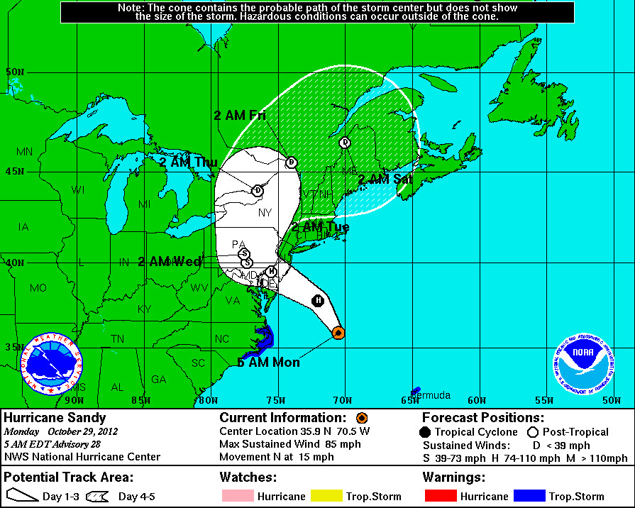
As of 5 a.m. Monday morning, hurricane Sandy was located 385 miles southeast of the New York metropolitan area. The storm is moving at 15-miles-per-hour up the East Coast on Monday morning and will soon be starting to turn to the left and aiming for the Delaware-New Jersey shoreline, according to the National Hurricane Center in Miami, Fla.
Schools across Long Island including the Elmont, Franklin Square, and Sewanhaka School districts have closed today in preparation for the storm's arrival. On Sunday, the New York City Office of Emergency Management announced that Belmont Park would be closed on both Monday and Tuesday. The facility's Grandstand structure will be used as an official evacuation center. OEM personnel will be on site at throughout the storm to assist evacuees, operating on the first floor of the Grandstand at Belmont. Evacuees reporting to Belmont will be aided and transferred to nearby shelters.
At 5 a.m. on Oct. 29, this “superstorm” was intensifying, increasing the certainty that it will bring hurricane-force winds up to 85 mph, drenching rain and heavy tidal surges from Maryland-Delaware to Long Island and beyond. In its 5 a.m. briefing, the National Hurricane Center predicted that there was an 80 percent chance the South Shore could see hurricane-force winds in the coming days, and there was a 50 to 70 percent chance that coastal areas of Long Island could see a tidal surge of at least four feet.
Sandy's greatest impacts will be felt on the South Shore from Monday afternoon into Monday night, according to the National Weather Service. The storm was predicted to weaken Tuesday into Wednesday.
Hurricane center officials said one of the storm’s most dangerous elements would be a “significant storm surge,” with the Atlantic Ocean rising three to six feet above normal levels in many areas, potentially inundating low-lying areas. The estimates were that the ocean level could rise one to two feet above astronomical tides on Sunday, two to four feet on Monday morning and potentially five to 10 feet Monday into Tuesday, depending on location.


