
 39.0°,
Fair
39.0°,
Fair Gibsonites plan action over flood maps
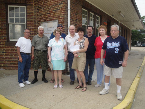
Valley Stream residents from the village’s southern half gathered for the second time at the Gibson train station on June 6 to discuss their concerns about the Federal Emergency Management Agency’s National Flood Insurance Program.
Their complaints focused on the federal government’s recently updated flood insurance maps, which added hundreds of Gibson homes to the flood zone.
The National Flood Insurance Program, administered by the federal government, requires homeowners with mortgages who live in designated flood zones to purchase flood insurance. If a homeowner chooses not to do so, the bank that issued the mortgage will buy the insurance and add the cost to the homeowner’s mortgage payments.
Some local residents said they feel that this situation is unjust because they have never experienced a flood. Regina Pardo-Davis, who has been living on Drew Street for eight years, recalled her initial reaction when she learned she had to buy insurance. “Anger. Pure anger and frustration,” she said. “Bewilderment, because I have never had a problem with a flood.”
Joe Ochoa remembered being startled by the letter that was sent to his home with the details about flood insurance. Ochoa said he was shocked “because I have never heard of that here.” He had lived on Filbert Street for nine years, but the possibility that it could flood was new to him, he said.
To determine whether a home falls in a flood zone, FEMA analyzes a property’s elevation using the Light Detecting and Ranging Radar system. Officials fly over an area and shoot lasers down to the ground that bounce back up to the plane and measure ground elevation.
Some residents said they think that this is an inaccurate method. “The state, county and village engineers should do independent or combined surveys to show the inaccuracies of the FEMA maps and have them corrected,” said Carol Crupi, the coordinator of the residential meetings. “Why should the homeowner have to prove they are not in a flood zone? Let FEMA prove they are.”
To appeal their flood insurance status, residents may file for a Letter of Map Amendment for their homes, though the process will cost them. A homeowner must hire a surveyor, who may charge up to $600 to assess property and compare the height of the first floor with potential flood elevation. Property is removed from the flood plain map only if it is above flood elevation.
“I battled this for half a year,” said Alan Schaechter, a resident of Gibson Boulevard for 55 years. “I lost.”
Schaechter filed for a map amendment and hired a surveyor to evaluate his home. He was later notified by FEMA that his house was below the flood zone elevation, and would therefore remained on the flood plain map.
He said that the federal government is causing another economic crisis, and that this is the wrong time to be doing these revisions. “I believe that because of the housing crisis, this is going to cause a depression,” said Schaechter, adding that the flood insurance situation would create more problems in the housing market that President Obama does not want.
Depending on a property’s elevation and whether the home on it has a basement, NFIP rates vary. Premiums can range as high as $9,000 per year.
Homeowners had the chance to hold down the cost of flood insurance by purchasing coverage prior to Sept. 11, 2009. Schaechter purchased his policy for $1,848, weeks after the cutoff date. “FEMA didn’t notify me,” he said.
Unexpected flood insurance bills brought financial difficulties to a number of families in Valley Stream. Pardo-Davis’s policy costs $2,500 a year — more than her normal home insurance cost of $1,600. “It affects every aspect of my yearly income,” she said of the extra expense.
Some residents hope to make a broad statement that this is a serious issue that needs to be dealt with not only in Valley Stream. One step requested by Pardo-David is “to try to unify the villages that are being affected” so people in several communities can work together to inform the federal government that residents are dissatisfied.
U.S. Sen. Chuck Schumer said he is willing to listen. “We will do everything possible to support the people of Gibson in their efforts to make sure that these FEMA maps are accurate and that no one is forced to pay for insurance that is not absolutely necessary,” Schumer said.
According to Crupi, a petition will be circulated around the community, and will then be sent to U.S. Reps. Carolyn McCarthy and Peter King, Schumer, Sen. Kirsten Gillibrand, Nassau County Executive Ed Mangano and Valley Stream Mayor Ed Cahill, in the hopes that they will help residents challenge redrawn flood maps because of their perceived inaccuracy.
Another meeting focusing on the issue is scheduled for June 27 at 2 p.m. at the Gibson train station.


