
 51.0°,
Fog/Mist
51.0°,
Fog/Mist Glen Cove braves winter storm
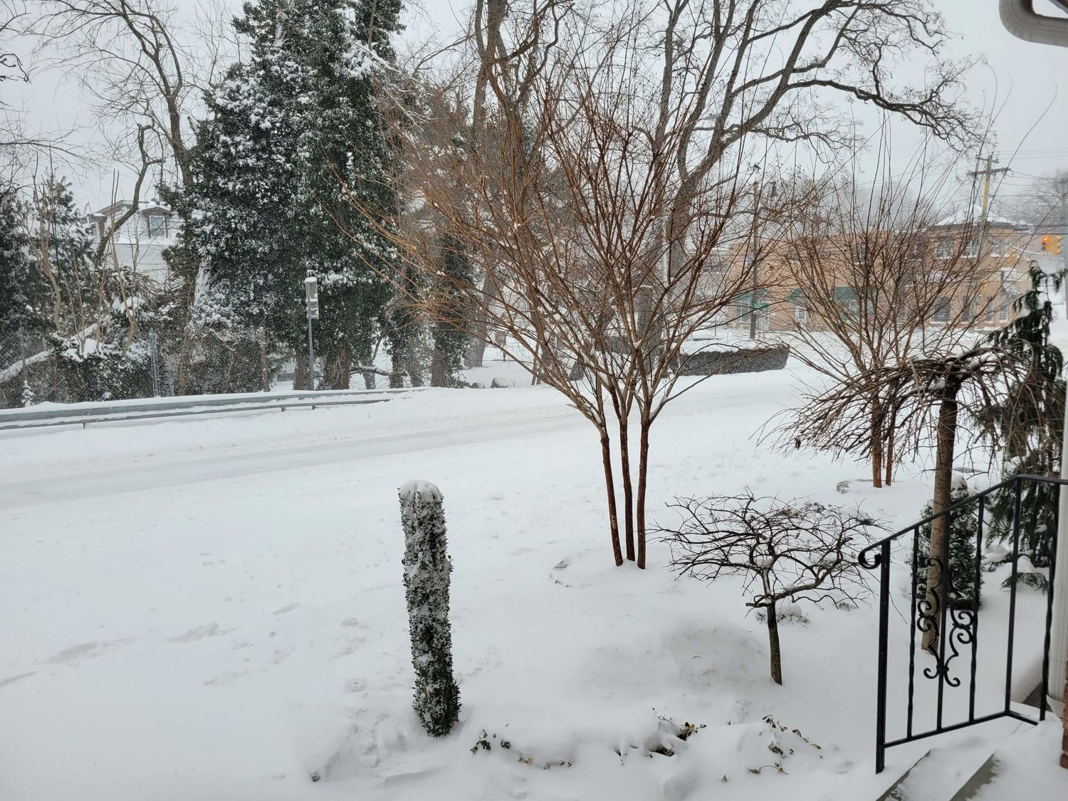


In the waning days of January, a nor'easter blew across Long Island Friday night into Saturday, bringing with it more than a foot of snow in Nassau County as of 9 a.m., with additional accumulations expected throughout the day.
County and town officials described road conditions as "dangerous" and said motorists should stay home if they do not have to go out.
Mayor Pamela Panzenbeck declared a snow emergency beginning at 2 p.m. on Jan. 28. All residents were advised to park their cars in driveways, on the odd side of their street, or in the Glen Cove municipal parking lots to allow Public Work employees to plow, salt, and sand the roads. Parking on Glen Street, School Street, and Bridge Street has been prohibited.
As of this morning, there have been no issues in the city's handling of the storm. According to Lou Saulino, director of Glen Cove Public Works, the city received an estimated six to nine inches of snow so far and has about 40 men and 12 trucks working to clear the roads. "Tomorrow I'm gonna have people out [to] clean by hand for all of our facilities...make sure City Hall is accessible by Monday when we open up," said Saulino.
Plowing began last night and will continue until about 4 p.m. today. "They are still out. They're going over the roads a couple of times," Panzenbeck said. "Roads are passible but people should stay in."
While driving through Glen Cove this morning, Panzenbeck reported that all streets, including main roads and residential side streets, have been cleared. "There are no black tops... haven't come across any unplowed roads yet," Panzenbeck said.
The Long Island Rail Road suspended service until further notice. The LIRR posted on its Twitter feed: "Safety first! We continue to operate patrol trains throughout the system to keep tracks and switches clear of snow and prepare for the resumption of service. Stay off the tracks at all times and do not go around lowered crossing gates, as a train may be approaching at any time."
PSEG-Long Island was reporting only scattered outages across the Island on its website. Electric system reliability was at nearly 100 percent, the utility said as of 9 a.m.
The temperature hovered around 20 degrees Fahrenheit in the early morning and was not expected to climb above the freezing mark throughout the day.
The temperature was predicted to dip overnight and remain in the 10- to 15-degree mark through Sunday.
At a news conference Friday, Nassau County Executive Bruce Blakeman urged county residents to stay inside their homes and off the roads.
"Our county is prepared for this event," Blakeman said. "We have 80 trucks that have been out already since this morning salting the roads, and they are out prepared to do more salting throughout the evening, and they will plow throughout the evening and tomorrow morning. We expect this to be a two-day event — what I mean by that is the roads won't be clear probably until Sunday morning."
Blakeman also advised residents to keep pets indoors and, in case of power outages, not to leave candles unattended in order to avoid fire hazards.
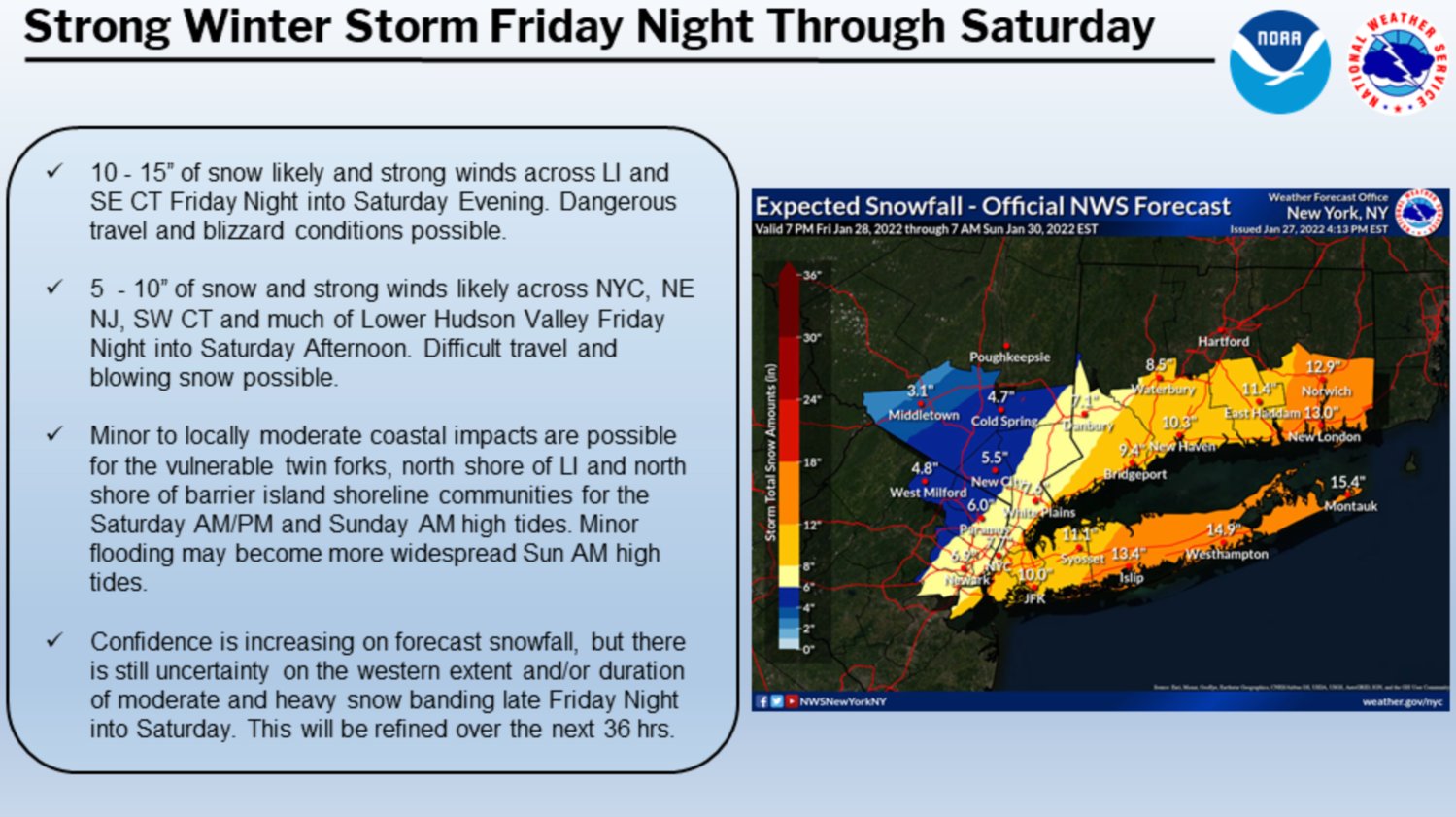
Below was the National Weather Service forecast for the Island:
Saturday
Snow, mainly before 4 p.m. High near 24. Wind chill values between zero and 5. Windy, with a north wind 25 to 30 mph, with gusts as high as 44 mph. Chance of precipitation is 90%. New snow accumulation of 5 to 9 inches possible.
Saturday Night
A 30 percent chance of snow, mainly before 7 p.m. Mostly cloudy, then gradually becoming mostly clear, with a low around 12. Wind chill values between -5 and 5. Blustery, with a northwest wind 20 to 24 mph, with gusts as high as 36 mph.
Sunday
Sunny, with a high near 27. Northwest wind 9 to 17 mph.
Sunday Night
Mostly cloudy, with a low around 19.
Monday
Mostly sunny, with a high near 34.


