
 81.0°,
Partly Cloudy
81.0°,
Partly Cloudy Strong rip currents expected for holiday weekend
Beaches reopen after Friday's closures


As Hurricane Earl swirled toward the East Coast, Long Beach officials prepared for a potentially severe, if downgraded and uneventful, storm that threatened coastal areas from North Carolina to Maine right before the start of a busy holiday weekend.
Beginning on Tuesday, officials from the city's emergency services, fire and police departments as well as the lifeguard corps met to prepare for Earl, which was expected to be felt locally on Thursday night or early Friday morning.
As of Friday, Sept. 3 at 10:30 a.m., the National Weather Service said Earl was expected to be 130 miles offshore from Montauk, and was downgraded to a Category 2 storm with winds down to 105 mph.
Even as Earl was ultimately downgraded, officials warned of strong rip currents. Although hot and sunny weather is predicted this weekend once the storm passes to the east, the Nassau County Office of Emergency Management said that the ocean could still be affected.
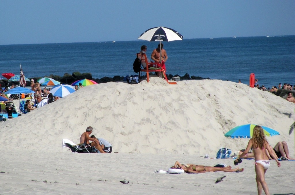
According to the Long Beach lifeguards, there was no swimming permitted on Friday due to intense surf and extreme rip currents, although surfing was allowed. With wave swells ranging between 6-10 feet, the waves were a boon to surfers.
"Today was amazing," said surfer Richard Burke.
Long Beach lifeguards said that swimming was permitted on Saturday, but only up to the knees, due to roiling surf and extreme rip currents. Swimming was permitted on Monday, although beachgoers were asked to pay attention to lifeguard instructions.
City Manager Charles Theofan said on Wednesday that it looked as if the storm would pass Long Beach by, and Earl ultimately overshot the barrier island, aside from creating some rough surf. "It doesn't look like the hurricane will hit," Theofan said Wednesday. "We have a very good hurricane plan in effect and we are monitoring it, but we're not really talking about evacuation just yet."![]() Throughout the week on the city's website, Theofan urged residents to sign up for the Swift 911 emergency-alert telephone system. Residents can register at www.longbeachny.org or by calling 431-1000 ext. 7105.
Throughout the week on the city's website, Theofan urged residents to sign up for the Swift 911 emergency-alert telephone system. Residents can register at www.longbeachny.org or by calling 431-1000 ext. 7105.
According to Long Beach's chief of lifeguards, Paul Gillespie, ocean swells and rip currents were expected to continue over the weekend. Gillespie urged beachgoers to swim only when lifeguards are on duty. "Right now it's all models, but it all depends on the wind," he said of pinpointing Earl's trajectory toward Long Beach.
Gillespie, who spoke to the Herald from the National Boulevard beach on Tuesday, said that rip currents have been strong since Aug. 29, a day on which lifeguards rescued some 100 swimmers. "I'm looking at the water right now and the rip currents are there, but the wave surge isn't there yet," he said.![]()
Earl did not lead to any beach closures Tuesday through Thursday, although it initially threatened to cancel the National Beach Tennis Championship scheduled for the weekend, as well as the Annual John Daly Swim at National Boulevard on Sunday, both of which were expected to proceed as scheduled.
On Friday, Nassau County officials declared the following beaches closed to swimmers:
- Jones Beach
- Tobay
- Village of Atlantic Beach
- Long Beach
- Nickerson Beach
- Point Lookout
- Lido
- Lido West
- Mailbu
- East Atlantic Beach
Earl initially had officials gearing up for the worst, and Gillespie took part in a conference call with nearby beach patrols, including those at Jones Beach and Robert Moses, to gauge the intensity of rip currents and wave surges. Another call was scheduled for Thursday in preparation for a storm surge.
"We put mounds in front of entrances to the beach and moved some [lifeguard] chairs back," he said. "On Roosevelt and Pacific, we're moving chairs behind dunes, and taking out the roadway — that beach could be completely wiped out," he said. "It's going to be hairy and a lot of work for the city. You have to be ready."![]() City Councilman John McLaughlin said on Wednesday that while it looked as if Earl would skirt Long Beach to the east, there was still some reason for concern. "The way that the storm is tracking right now, it doesn't look like we're going to bear the brunt, but you never know," McLaughlin said, adding that a storm surge could impact Reynolds Channel as well.
City Councilman John McLaughlin said on Wednesday that while it looked as if Earl would skirt Long Beach to the east, there was still some reason for concern. "The way that the storm is tracking right now, it doesn't look like we're going to bear the brunt, but you never know," McLaughlin said, adding that a storm surge could impact Reynolds Channel as well.
Theofan urged residents to check supplies and recommended keeping tabs on neighbors who may need assistance in the event of a severe storm.
Officials urged residents to check the city website for updated information on hurricane activity. Residents can also call the city's storm hotline at 431-1000 ext. 1. The storm can also be tracked on the National Hurricane Center's website, www.nhc.noaa.gov.
Comments about this story? ARifilato@liherald.com or (516) 569-4000 ext. 213.


