
USGS to study Island Park waters
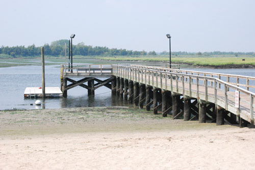
Visitors to Masone Beach in Island Park will soon encounter a new piece of technology on the dock as a recent agreement was signed between the United States Geological Survey and the New York State Department of Environmental Conservation.
Due to a desire to protect local waters from pollution and analyze current trends in data, a tide elevation and water quality monitoring system was recently installed, with plans to keep it there for a minimum of two years. This partially submerged machine is responsible for determining the water temperature, as well as its conductivity, turbidity and chlorophyll levels.
“The South Shore Estuary Reserve Program is continually trying to improve the health of the people living on Long Island,” Richard Cartwright, an hydrologist from the United States Geological Survey, said. “This small structure provides continuous water quality data at six minute intervals, a big step up from the spotty data provided in the past at a rate of once or twice a week.”
Through the use of solar panels on the surface of the monitor, constant updates are sent directly to satellites, which transmit the information to base stations located throughout New York. This information is available to the public by visiting the organization's website, as well as information derived from studies of other bodies of water throughout the county. For the first time on Long Island, nitrate monitors will also be used on the system to determine the level of nitrates in the water and compare them to local and national averages.
One of the main goals of the project is to determine the total maximum daily load levels of the West Bay Area. As outlined in the U.S. Clean Water Act passed in October of 1972, the total maximum daily load determines the maximum amount of pollutants a body of water can have and still meet water quality standards.
“We hope that by analyzing the trends in data we can determine why fish are being killed, why certain areas tend to spawn large amounts of algae and why certain beaches are more susceptible to closures,” Cartwright said.
By working together with Stony Brook University’s School of Marine and Atmospheric Sciences, Masone Beach was chosen by a panel of environmental scientists who wanted to have a location west of the mid-West Bay Park area to compare the results found at the eastern Point Lookout location.
Despite the large amount of information being transmitted, the monitoring system will not get in the way of people that choose to visit the beach. "The system is in an ideal location," said Island Park Mayor Jim Ruzicka. "It will show one way or another if our local water quality is improving, and how to change it if it's not."
“It’s nice to see people interested in what we do,” Cartwright said. “If funding continues and it ends in positive results we’d like to keep it there indefinitely.”
Comments about this story? Oceaneditor@liherald.com or (516)569-4000 ext. 269.


